 Summer in Maria Alm
 Brochures
 Hochkönig Card
 Salzburgerland Card
 Booking Enquiry
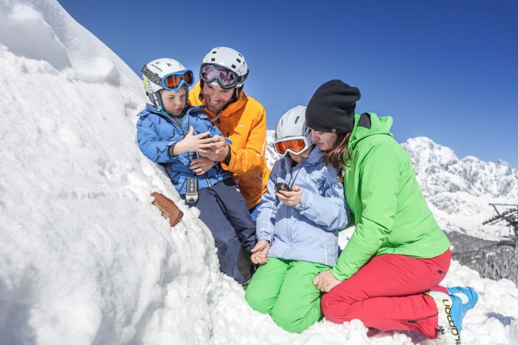 Winter in Maria Alm
 Picture Gallery Summer
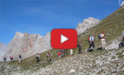 Videos Maria Alm
 Picture Gallery Winter
The King's Tour
A SKI TOUR WITH 6 PEAKS, 7,500 METRES OF ALTITUDE AND BREATHTAKING PANORAMIC VIEWS


Geochoaching
Also this winter there are 15 treasures (caches) to discover along the grandiose descents on the tracks of the royal tour in the Hochkönig ski area. What is geocaching?
Geocaching can best be described as a modern treasure hunt with GPS devices. A "cache" stands for a treasure that can be found with a GPS device. Geocaching is a worldwide treasure hunt. In the hidden containers, the so-called caches, you will find a logbook (please fill it in), a pen and some small things to exchange. To show other players that you have found a cache, you can register for free at www.Geocaching.com and enter the successful find there.
Attention, addiction potential! Just try it out!
TIP: Free GPS loan devices (deposit € 50,--) and geocaching folders with the geocoordinates are available at the tourist offices Maria Alm, Dienten & Mühlbach available. Alternatively you can find the Geocaching App and the Geocoordinates of the King's Tour at www.geocaching.com .

Connections New
We connect what is one. With the realization of the connection Aberg - Natrun we connect what belongs together for a long time. The long-standing vision of a Ski-In / Ski-Out connection in the heart of Maria Alm directly to the Königstour will be continued until the Start of winter season 2018/19 completed. The existing five summits of the tour will be extended by Natrun. On six peaks and an incredible 35 kilometres of slopes with 7,500 metres of altitude difference, new high feelings are created amidst romantic mountain huts and the breathtaking panorama.